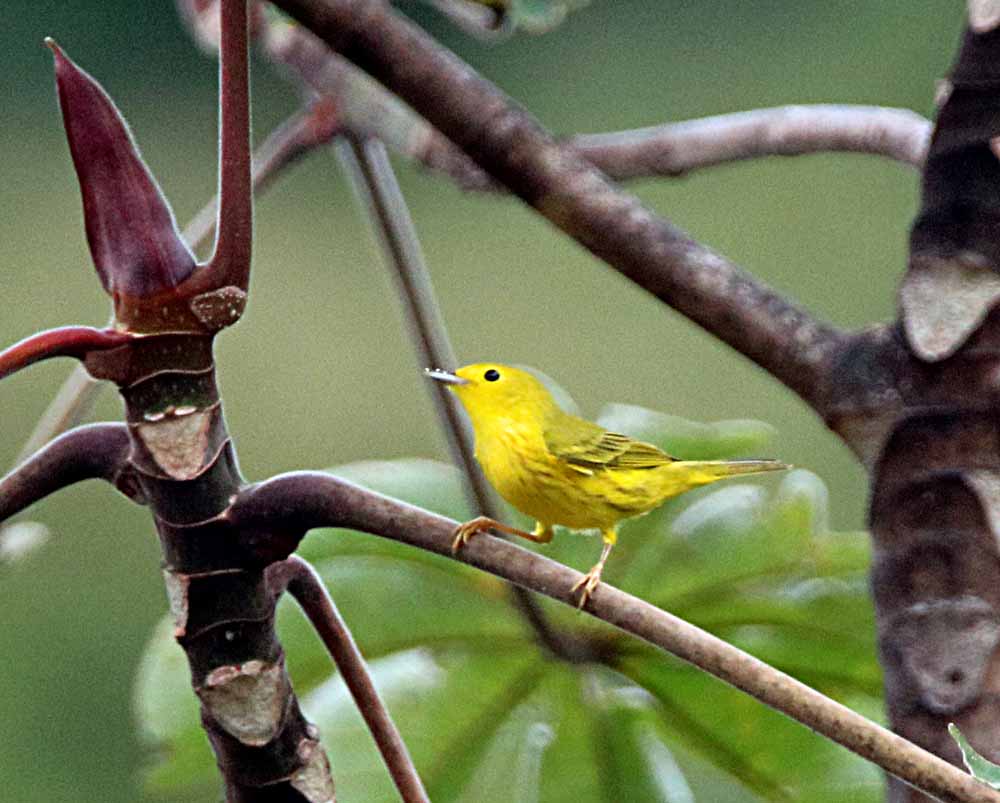
I used to see a lot more of these but that was back when I saw a lot more of all birds than now. It is the Yellow Warbler, Setophaga petechia (eBird link) which is found in all of the lowlands of Costa Rica but be aware that some books are now separating the American Yellow Warbler (Setophaga aestiva) and the Mangrove Warbler (Setophaga petechia) which is the one that is a resident of Costa Rica while the American are migrants from the north and also here. The Mangrove Warbler is best known to birders as the one whose male has a chestnut red head. The females seem to be identical. You can see both in my Gallery of Yellow Warblers. And eBird has kept them together as I do in my gallery. Here’s 3 shots from my garden . . .
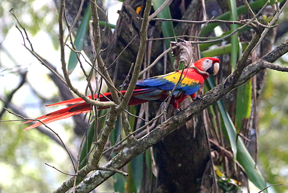
We saw many Scarlet Macaws on Rio Tarcoles but none where we could get a good picture, but as we were leaving the village of Tarcoles on our way to Punta Leona, we saw this one along the side of the road and thus it is my only photo of one this trip! But I have a lot more photos in my Scarlet Macaw Gallery. 🙂
Scarlet Macaw, Tarcoles Village, Puntarenas, Costa Rica
This Scarlet Macaw lives mostly on the Pacific Slope of Costa Rica with a few going over the continental divide to the Atlantic or Caribbean Slope. They are listed as “threatened” and are decreasing in numbers because of habitat loss, but not listed as “endangered” yet like the Great Green Macaw which lives only on the Caribbean Slope. There are Ara Projects for both species working to save them in the wild. In Limón Province at Manzanillo there is the AraManzanillo(Green Macaw Project) and for this Scarlet Macaw there is on Nicoya Peninsula the Macaw Recovery Network which is working to preserve this beautiful parrot. Both programs use nesting boxes in the wild because there are not as many old trees left with natural holes for nests. I’ve seen these nesting boxes at both Hotel Punta Leona and at Tambor Tropical Resort. They work! with lots of macaws nesting in both places. And Maquenque Eco Lodge is adding nesting boxes and planting almond trees (favorite food of macaws). In fact, I planted one of the almond trees the last time I was there! 🙂
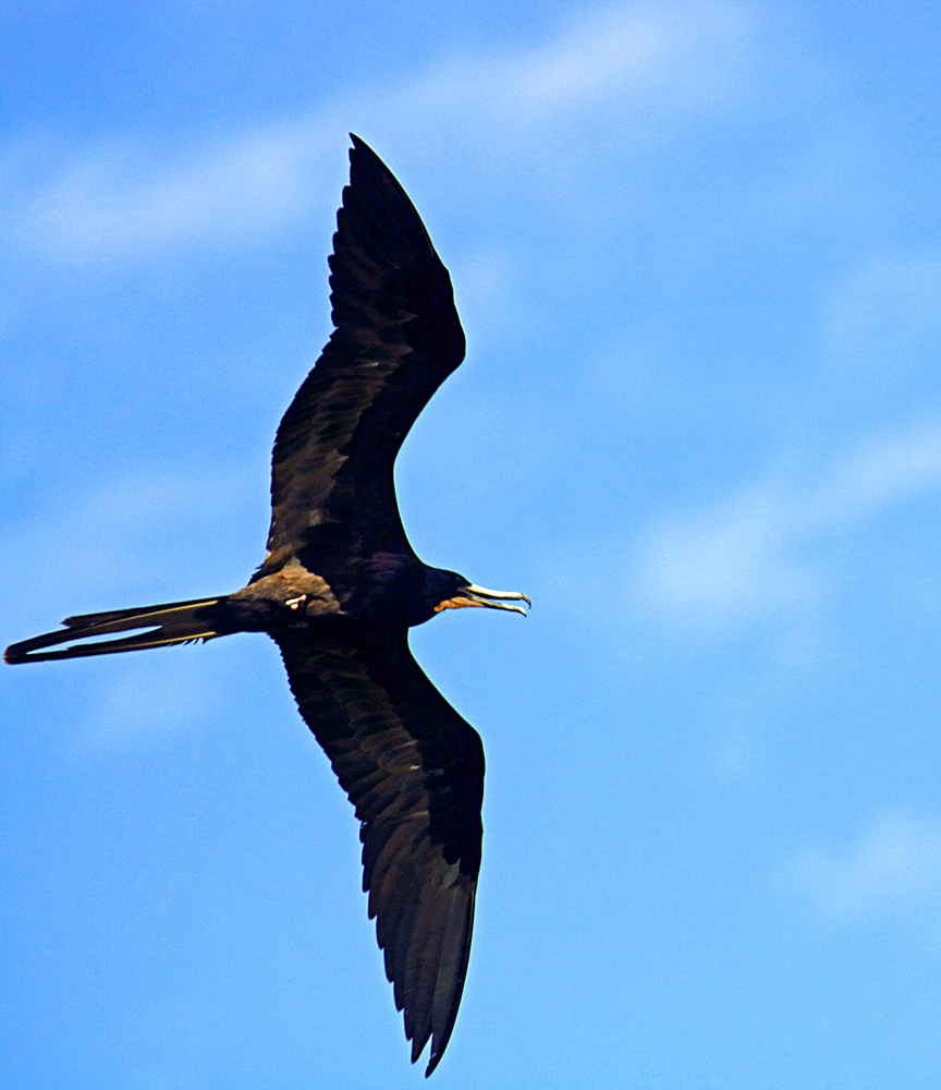
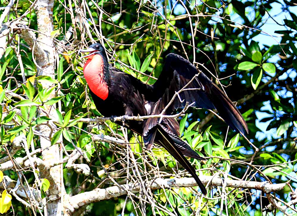
Our birding boat trip on Rio Tarcoles was both in freshwater and in the brackish tidal water near the mouth of the river and of course mangroves there. Mangroves are near the mouth of all rivers and where you see lots of seabirds and many use the mangroves to birth and raise their young, just like a lot of the sea fishes. So it is a rich in nature place to photograph nature. Today I’m sharing the biggest bird we saw, the Magnificent Frigatebird, Frigata magnificens (linked to eBird) and you can see my photos from 7 different sightings since coming to Costa Rica at my Magnificent Frigatebird GALLERY. Here’s four shots from this sighting . . .
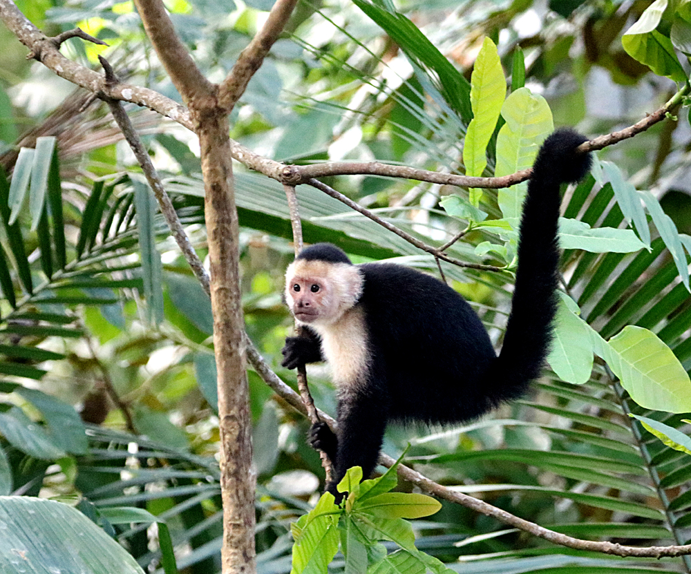
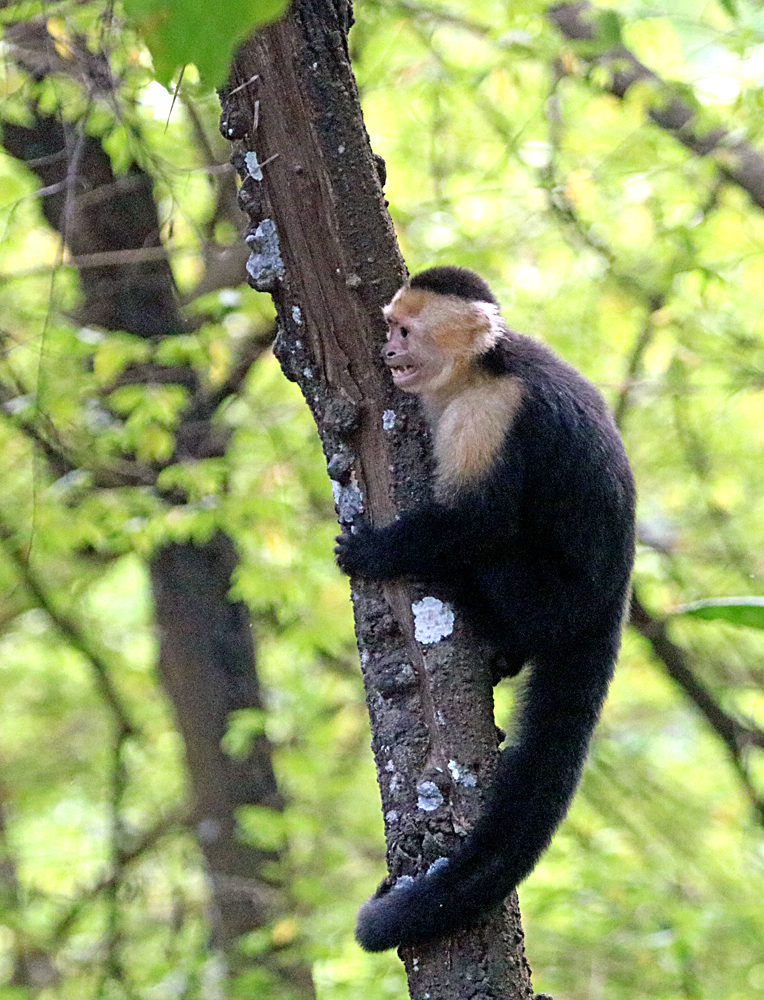
I’m still working on my hundreds of photos of birds photographed on Rio Tarcoles Monday, so I will start with one of the last things we saw, a Troop of White-faced Capuchin Monkeys among the trees along Mantas Beach (Playa Mantas), which I first visited while staying at Hotel Punta Leona in March of 2019. The beach photo below was made then. 🙂 The hotel and resort development owns most of the land but the government says beaches cannot be private, so Walter took us to a little trail at the end of one street in the village of Punta Leona to get here, mainly for the monkeys and sloths. I did not get a sloth photo this time, but some of my Canadian friends did. To see more of these monkey photos, go to what will become a sub-gallery of this Trip Gallery: Playa Mantas Monkeys 2025 or if you want more, see my capuchins from all over CR in gallery: White-faced Capuchin Monkeys.
White-faced Capuchin Monkey, Playa Mantas, Punta Leona, Costa Rica
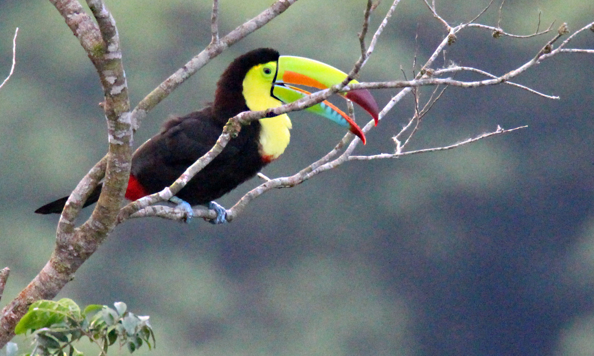
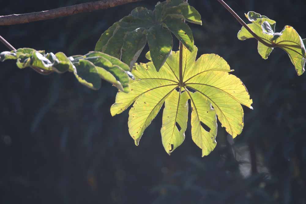
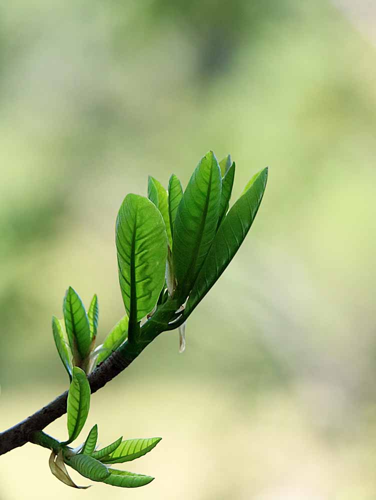
These photos are from my kind of “catch all” category that I call “Leaves and Nature Things.” In this case, all leaves with one whole tree on the hill above my house. Tomorrow will start January pix and tomorrow is when I’m taking some Canadian friends birding on the Tarcoles River early, then looking for monkeys on Punta Leona Beaches with Walter. A full day, so those pix won’t be until at least the next day or later but coming! 🙂 Then Wednesday I go see the doctor in San Jose who is monitoring the possible spread of my facial cancer. And another morning will be given to visiting Dan Sheaks’ bird feeders where he gets a lot of toucans! So a busy week again! 🙂
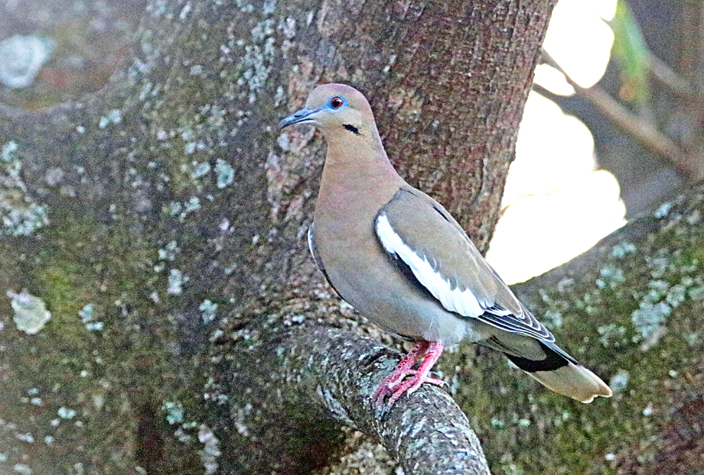
My most frequent visitor of the Doves & Pigeons looks like he/she owns that tree! 🙂 See more of my photos of this species, including a nest, in my Gallery: White-winged Dove.
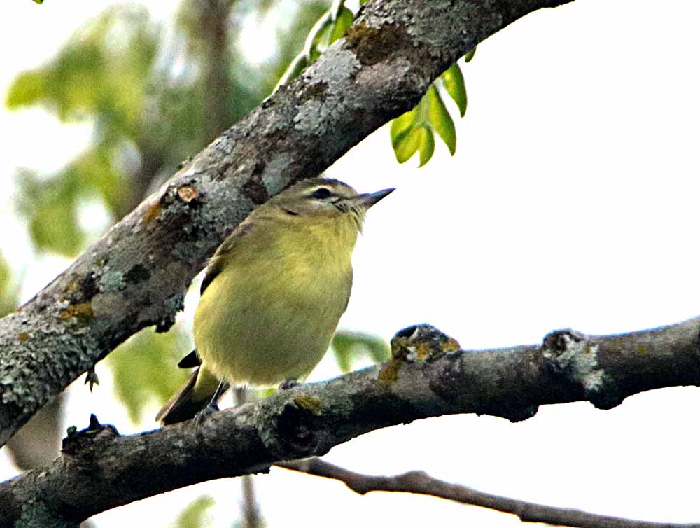
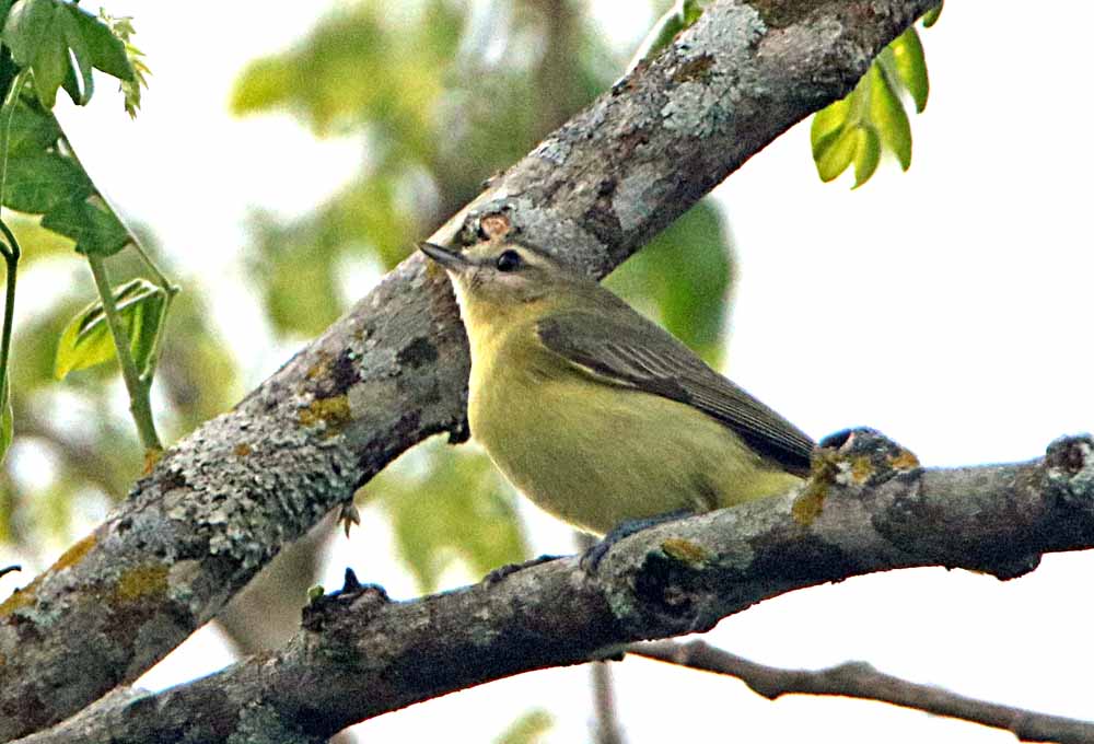
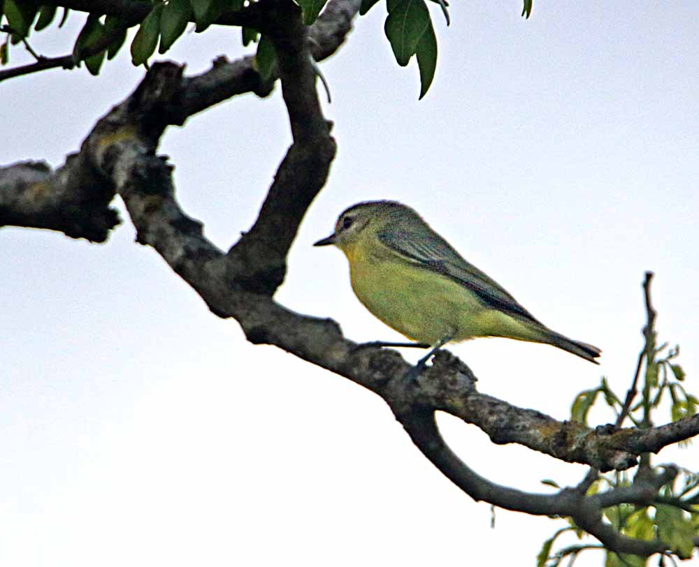
Yes, on Christmas Eve, in the tree by my terrace at Xandari, I photographed another new species for me! This Philadelphia Vireo, Vireo philadelphicus(linked to eBird) was identified by the Merlin app from eBird and is probably a non-breeding immigrant from Canada who passed through Philadelphia on his/her way to Costa Rica. 🙂
Philadelphia Vireo, Xandari Resort, Tacacori, Alajuela, Costa RicaPhiladelphia Vireo, Xandari Resort, Tacacori, Alajuela, Costa RicaPhiladelphia Vireo, Xandari Resort, Tacacori, Alajuela, Costa Rica
¡Pura Vida!
Other Vireos, for you birders reading, that I’ve collected in Costa Rica linked to my photo galleries of each:
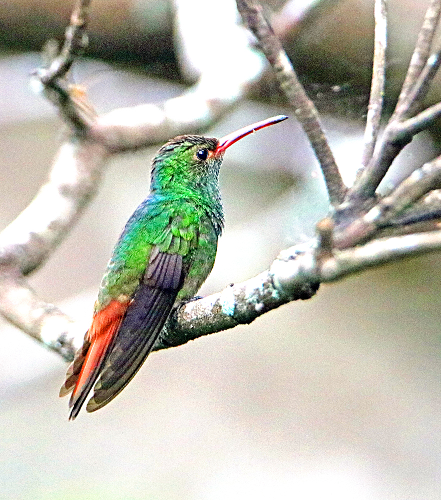
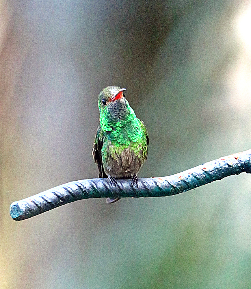
The Rufous-tailed Hummingbird, Amazilia tzacatl (linked to eBird) is a Central American bird overlapping only into the northern edges of South America and found literally all over Costa Rica as can be seen in my GALLERY, Rufous-tailed Hummingbird. It has long been the dominant hummingbird in my garden, often chasing off other species, though now I am seeing just as many or more of the Blue-vented Hummingbird. Here’s two shots of this species in my garden recently, the first a juvenile or immature adult (smaller) and the second a mature adult . . .
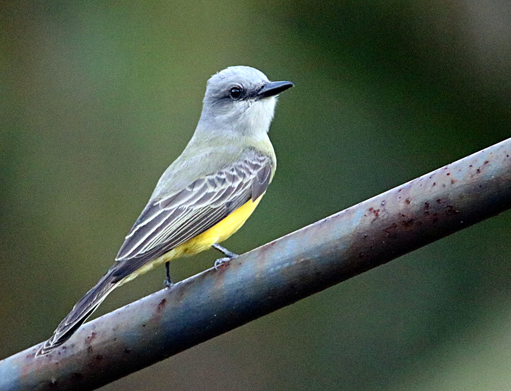
I remember seeing this bird on my first trip to Costa Rica back in 2009, down on the southern end of Osa Peninsula near Corcovado NP at Lookout Inn, Carata. He’s a handsome bird without the extravagant colors of many tropical birds. And now he’s a regular in my garden! 🙂 See more photos in my gallery for the Tropical Kingbird, Tyrannus melancholicus from literally all over Costa Rica and that first I saw is at the bottom of the gallery. 🙂
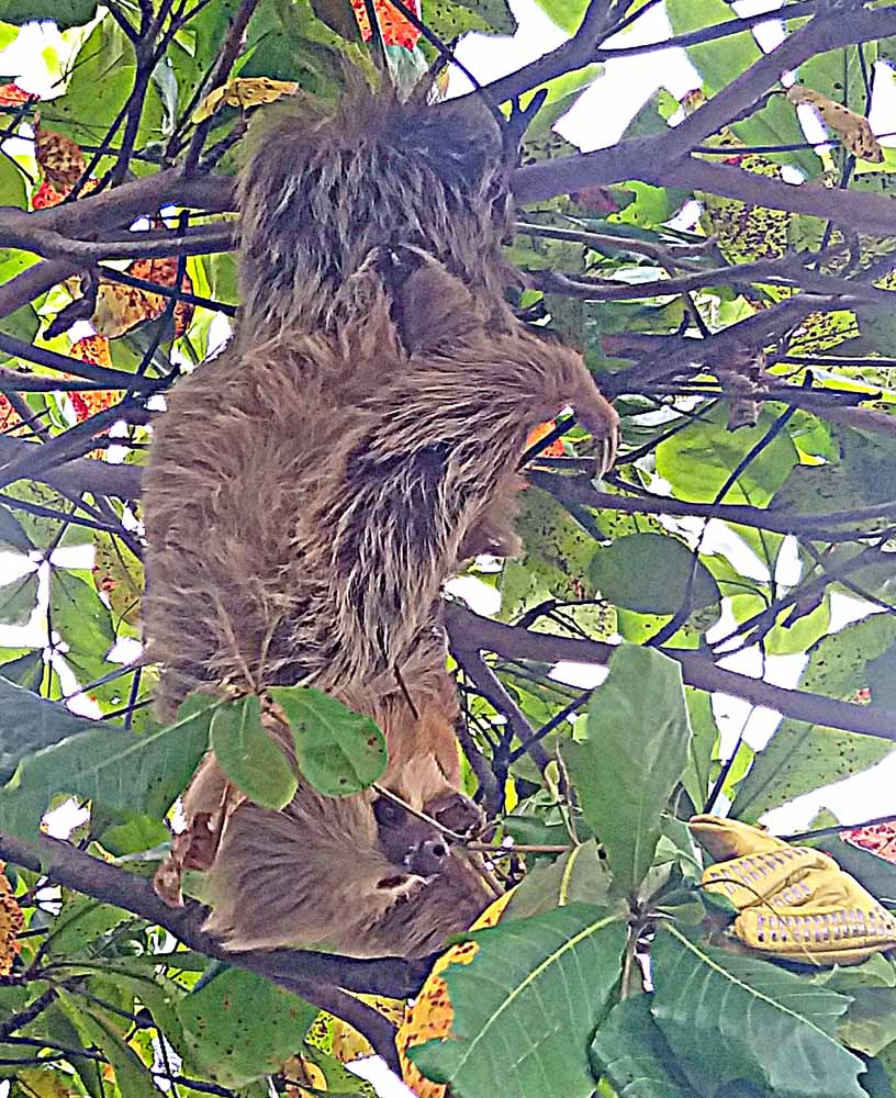
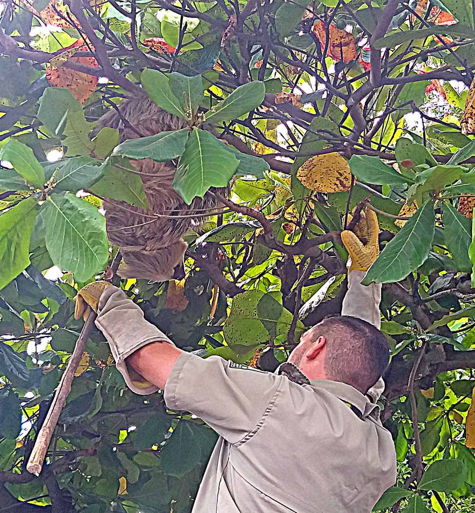
. . . on a busy street in downtown Atenas, Alajuela Province, Costa Rica. I was in a taxi running errands downtown when I realized that the man in the tree was not a tree-trimmer but a National Park employee rescuing a Hoffmann’s Two-toed Sloth, Choloepus hoffmanni (my gallery link) from a tree near Central Park on a busy street full of businesses where he/she would certainly be killed by a car soon. He/she will be taken to a national park or wildlife reserve to live peacefully in the wild as God intended. I jumped out of the taxi and tried to make a few photos with my cell phone, which show what was happening but are not good shots of the sloth. They are all difficult to photograph as mainly big balls of fur that don’t frequently show their faces (both 2 & 3 toed). Just a report of a moment of excitement in busy, pre-Christmas, downtown Atenas! (For which my stopped taxi blocked traffic for about a minute on Calle 1!) 🙂
Sloth Rescue, Downtown Atenas, Alajuela, Costa Rica
More photos in the online version of the blog post . . .