

1871 Map Shows Church Located in Two Places
This further adds doubt to relation of cemetery & church
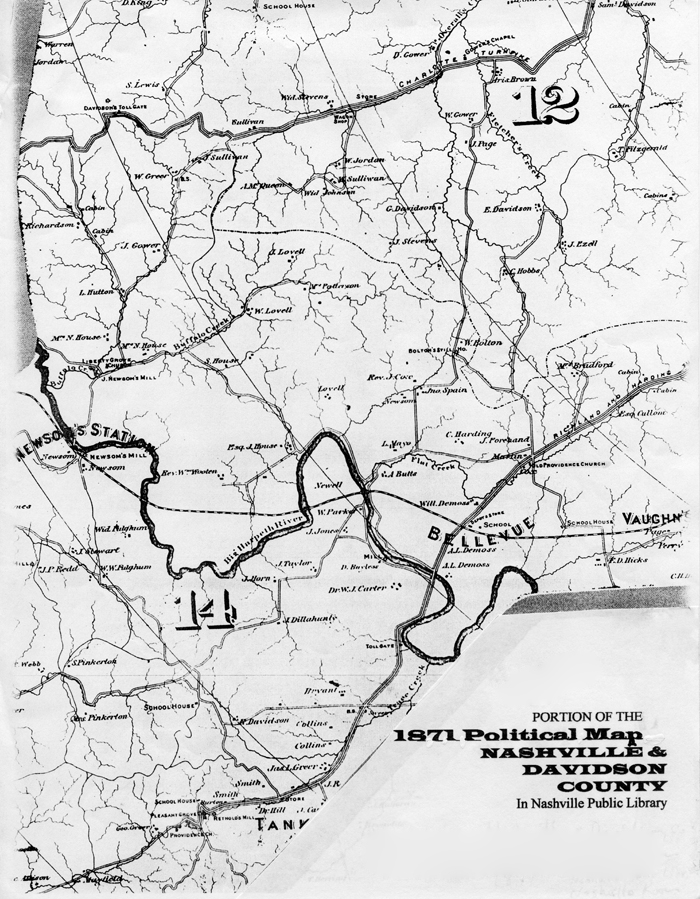 1871 Map
This Nashville Public Library 1871 Map of Davidson County shows Providence Church in two places.
- “Old Providence Church” is on the right side above the last E in BELLEVUE on the Richland and Harding Road by property labeled “Marlin.” It is north of Flat Creek which is sometimes referenced.
- “Providence Church” is near the bottom left of map near Reynolds Mill which is sometimes referenced
The confusing part is that Edythe Whitley Papers say the church merged with Big Harpeth Church after the Civil War. If so, are both of these former locations? And I have not been able to tell if the “Old” location is exactly where
the cemetery is located. Further study might show that the cemetery was not beside the church as Whitley said.
(That’s what I said then. Note that none of the documents I found about the church indicated a cemetery, even though common for churches then. I now believe that Whitley’s inaccurate research and reporting are simply wrong. This particular cemetery had nothing to do with the Providence Church and is likely to have been a community cemetery because of the many family names included, but I will not begrudge those wanting to call it the DeMoss Cemetery, since he was the founder of Bellevue, but I personally do not believe it was a DeMoss Family Cemetery. CD-June 2018)